
Questions Answers For All Chapters – Geography Class 6
Exercises-Solutions
(A) Put a tick mark against the correct option in the space given.
1. 66° 30′ North parallel means:
✔ Arctic Circle
2. Which parallel bisects the Earth?
✔ Equator
3. What is the angular distance of the Arctic Circle from the North Pole?
✔ 23° 30′
4. Where do the Prime Meridian and the Equator intersect each other?
✔ Atlantic Ocean
5. Up to which parallels from the Equator can the sun’s rays be perpendicular?
✔ Tropic of Cancer and Tropic of Capricorn
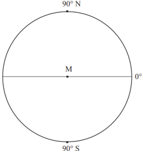
6. What would be the latitude of a place on the South Pole?
✔ 90° S
(B) Read the following statements and correct the wrong ones.
1. While describing the location of a place, mentioning the meridian is sufficient.
❌ Wrong → We need both latitude and longitude to describe a location correctly.
2. For describing the extent of a region, it is necessary to assume the latitude and longitude of the center of the adjoining region.
❌ Wrong → The extent of a region is described using the extreme latitudes and longitudes of that region.
3. Location of a road can be described only with a map.
❌ Wrong → The location of a road can be described using latitudes and longitudes of its starting and ending points.
4. 0° East meridian and 180° East meridian.
❌ Wrong → The correct terms are 0° Prime Meridian and 180° Meridian.
5. The extent of a road or a river course is described with the help of the latitude of a point in the source and the longitude of a point at the end.
✔ Correct
6. 8° 4′ N parallel to 37° 66° N parallel is the correct description of a location.
❌ Wrong → The correct way to describe a location is to mention the correct latitudinal and longitudinal values.
(C) Find the locations of following cities from a world map, a map of India or a Globe and write down the latitude and longitude of each of them.
| City | Latitude | Longitude |
|---|---|---|
| Mumbai | 19° N | 72° E |
| Guwahati | 26° N | 91° E |
| Srinagar | 34° N | 74° E |
| Bhopal | 23° N | 77° E |
| Chennai | 13° N | 80° E |
| Ottawa | 45° N | 75° W |
| Tokyo | 35° N | 139° E |
| Johannesburg | 26° S | 28° E |
| New York | 40° N | 74° W |
| London | 51° N | 0° W |
(D) Find and write down the extent of the following (Check them on the internet or mobile)
1. Maharashtra (State) → 15° N to 22° N latitude, 72° E to 80° E longitude
2. Chile (A country) → 17° S to 56° S latitude, 66° W to 75° W longitude
3. Australia (A continent) → 10° S to 44° S latitude, 113° E to 154° E longitude
4. Sri Lanka (An island) → 5° N to 10° N latitude, 79° E to 82° E longitude
5. Trans-Siberian Railway (Russia) – from St. Petersburg to Vladivostok
- St. Petersburg → 59° N, 30° E
- Vladivostok → 43° N, 131° E
(E) Draw important parallels and meridians on the given figure and label them.
(This is an activity-based question where you need to draw and label the important latitudes and longitudes on a blank world map.)
(F) Write the important parallels and meridians in the following table
| Important Parallels | Important Meridians |
|---|---|
| Equator (0°) | Prime Meridian (0°) |
| Tropic of Cancer (23.5° N) | 180° Meridian (International Date Line) |
| Tropic of Capricorn (23.5° S) | 90° E and 90° W Meridians |
| Arctic Circle (66.5° N) | 45° E and 45° W Meridians |
| Antarctic Circle (66.5° S) | 135° E and 135° W Meridians |
| North Pole (90° N) | – |
| South Pole (90° S) | – |
Leave a Reply